
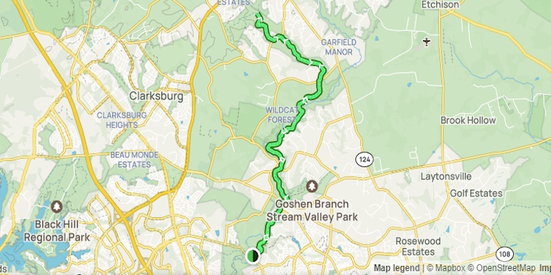
This approximately 6.5 to 7 mile north to south linear hike took place on Friday, December 30, 2023. It was myself and my cousin Ron Calabrese on this one.
I met Ron at the McDonalds in Damascus, MD at around 8:45 AM on Friday, December 29, 2023. We first drove two vehicles to where we would end this hike along Watkins Mill RD near the intersection of Apple Ridge RD. I parallel parked my vehicle along Watkins Mill RD right where the SCGT crossed Watkins Mill. The GPS coordinates for where we staged my vehicle were:
39.187158, -77.215261
Next, Ron drove me to the northern end of where we were starting this hike. It was on Loghouse RD near Founders Way. It was a nice parking lot that held about 15 vehicles. The GPS coordinates for this location were:
39.244967, -77.206592
We then started the hike around 9:30 AM. We utilized the AllTrails app and specifically, the map for the Seneca Creek Greenway Trail Upper Section. There is a link to that map at the bottom of this page.
In my opinion, this trail was very easy to hike. There were some minor ups and downs but overall, it was rolling in nature. Initially, we were walking along the west side of Lower Magruder Branch. It was pleasant. Our first road crossing in about 1.5 miles was Watkins RD. This guy Watkins must have been very important around here as they named a road after him AND his mill.
After about a half mile or so we crossed the flood plain and a bridge over Great Seneca Creek, which came in from the northeast. We would be following the east side of this creek for the duration of this hike. Again the trail was rolling but not steep. It was well groomed and was high above the creek in most cases and very close to the backyards of the very nice houses adjacent to the trail.
Our second road crossing was at around the 3 mile mark at Huntmaster RD. The trail paralleled this this road for a short distance. This next stretch allowed us to make good time as the trail was well groomed and free of rocks, roots and blowdowns. We took at short break at around 4 miles.
At the 5 mile mark we got to Brink RD. We had to cross both Brink and Wightman RDS at this busy intersection. Here’s where it got interesting. The trail split right after this intersection. I believe that we should have gone left. We went right instead and ended up walking along a very muddy trail that was very close to Great Seneca Creek. At one point, we had to climb a short muddy hill. Ron almost slid into the creek and my cell phone almost followed him!
We rejoined the correct trail shortly. We would again see various trails branching off here and there as we were then passing through the Goshen Stream Valley Park. At around the 5.5 mile point we started a not too steep but long climb up a mountain. It reminded me of being on the AT somewhere down south. Nothing but forest and hills. I saw a bridge off to the left from the top of this mountain. As we came down the mountain we swung around and crossed this bridge over a tributary called North Creek.
I could hear vehicles in the distance. I knew that the hike would be over soon. We then went up a small rise, descended and there was my vehicle parallel parked along Watkins Mill RD. The hike ended around 12:45 PM. It came in at 7 miles according to Ron’s AllTrails app. He had the pay version and I only had the free version so his must have been correct.
We had GPS problems trying to get back to Ron’s vehicle. We got close to where needed to go. But the GPS kept taking us in circles. I tried entering the coordinates again. This time, it took us across MD 27 and again took us in circles. We had suficient cell signal so I’m not sure what happened. So I closed Google Maps, tried Waze and that got us back to Ron’s vehicle. We wasted about 30 minutes with the GPS snafu. But I got home by about 3:15 PM.
Ron and I both thought that this was a nice trail. There was parking for at least one vehicle at each road crossing. There is still a 3 or 4 mile paved section north of where we started. And there are probably two or three more day hikes that we could do between Watkins Mill RD and Clopper Lake. So I know that I will be returning to this area again in 2024.
Mike C
(Please note that we only hiked the lower half of the trail depicted and only one way from north to south.)
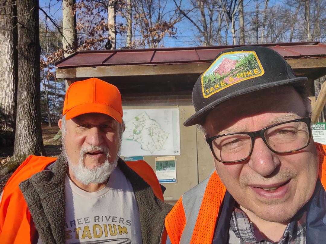
Trailhead Pic


< Previous Trip Log | << Outdoors | Next Trip Log >