
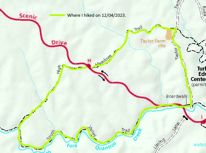
This approximately 4 mile loop hike took place on Monday, December 4, 2023. It was just me on this one.
Got a late start for this one. I left Manassas, VA at 8:00 AM, got to the trailhead and started this hike around 9:00 AM. It was 45 degrees when I started and would climb to around 50 when I finished. I started this hike at parking lot H in Prince William Forest Park near Triangle, VA. This park is only 4.5 miles from where I live. But to drive to it is 14 miles. That’s because I live 4.5 miles from the northwest corner of this 15,000 acre park and the entrance is at the southeast corner of it. Go figure.
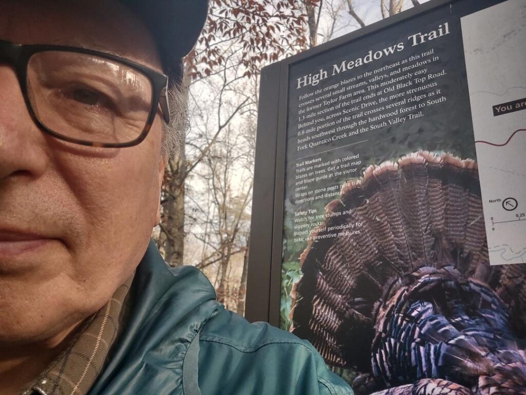
I started by going eastbound on the orange blazed High Meadows Trail for about .5 miles. I had to climb over three medium sized mountains and walk through two valleys within them. Each valley had a bridged creek crossing. It wasn’t bad. I passed the Taylor Farm Family Cemetery at around .4 miles, then reached the intersection with the Taylor Farm RD at .5 miles and at around 9:30 AM.
By the way, if you are looking for something fun to do in the winter, exploring the 41 family cemeteries in PWFP is a neat thing to do. There is a document online that lists where they all are. It was written by the then superintandent of this park in 1981. Do a search for “List of Family Cemetaries in Prince William Forest Park, VA” and a document that is stored within the Prince William County, VA archives should pop up. Use it to find these cemeteries. I have been to eight of them so far.
So I turned right onto the Taylor Farm RD and hiked it for about .5 miles. I had an initial up, then it was all downhill. This was a real road before this area became a national park. There were a number of drainage ditches on one side, than the other of this road. I hit the intersection with the South Valley Trail at around 9:55 AM. I would now be walking along the South Fork of Quantico Creek for the next 2.2 miles. I turned right, walked .2 miles, crossed the scenic road, then took a break.
Here’s where it got interesting. The South Valley Trail is, in my opinion, a very tough trail to hike. You have two small rock scrambles that require concentration. Then you have two big ups that go all the way to the top of the canyon that you and the South Fork of Quantico Creek are within. These obsticles both slow you down considerably. Now, I have been told that they are going to relocate this entire trail to the top of the canyon some day. That would be great! I hope that I am around to hike it.
I took another break in about a mile. I smelled a skunk then but didn’t see any. I passed a section of trail that had fallen into the South Branch of Quantico Creek about 5 or 6 years ago when I was a trail maintainer at this park. We had to relocate the trail about 10 feet further inland to get it back open again. I recognized the area that we relocated. I wanted to get to the intersection of the South Valley and High Meadows Trail by 10:30 AM. Didn’t happen. Because of the impediments listed above, I didn’t get there until 11:15 AM.
I took another break and took a Voke tab. These are beet/grape seed extract in a tablet about the size of a quarter. The final .8 miles were again three good sized mountains and two valleys both with a creek crossing over a bridge. I felt pretty good at this point. I think that Voke tab helped. With the exception of occasional planes flying overhead or loud traffic on I95 or VA234, the forest was very quiet and peaceful. I got back to my vehicle around 11:45 AM. I only did a bit over a mile an hour . But that’s OK, I had a beautiful day to hike and I thoroughly enjoyed it. Oh, and I have now lost 30 pounds since March, 2022. 30 more to go!
Mike C


< Previous Trip Log | << Outdoors | Next Trip Log >