This page may contain an affiliate ad banner and/or text link. If one clicks/taps on this link and then makes a purchase, I sometimes receive a small commission. Please patronize our advertisers.
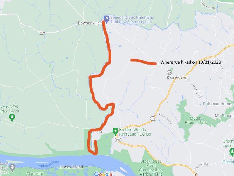
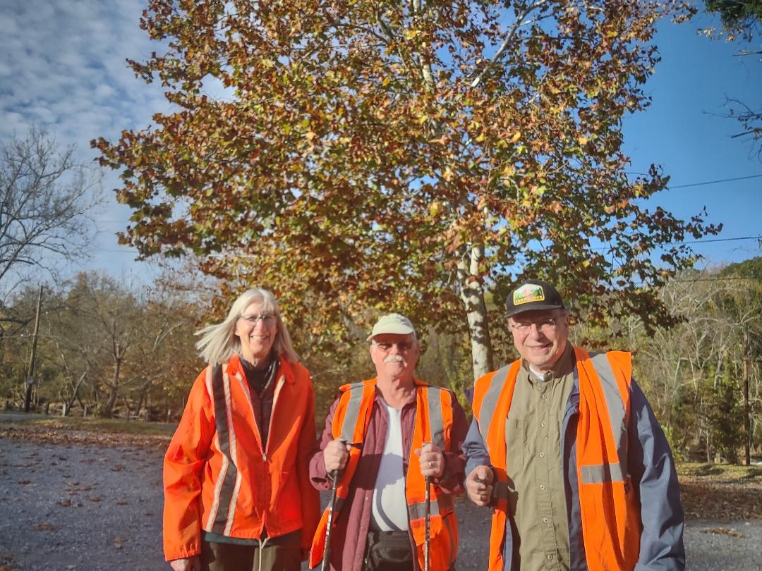
This 6.5 mile linear hike took place on Wednesday, October 31, 2023. Participants were Chris Isham, Charlie Johnson an myself.
I left Manassas, VA at around 7:00 AM and made it to the Seneca Creek Aquaduct Parking Area near Darneston, MD around 8:45 AM. Charlie was there already. Chris joined us shortly afterwards. We shuttled my vehicle to the MD 28 parking area just east of Seneca Creek. We started the hike at around 9:30 AM.
The signpost just past the trailhead parking lot said 6.5 miles. I thought that it would be 7 miles to the Potomac River. 6.5 sounded better. Most of this hike was on the east side of Seneca Creek. The trail was mostly level. There were a few “blips” or short ups. But it was an easy hike. So far.
We took a break just past the 3 mile mark. The trail was well blazed, signed, there were bridges on all water crossings except one. And the trail tread was good. After the break all was good until we hit the 5 mile mark. We had to walk along Berryville RD for about 250 feet, then went back into the woods. We had to cross a tributary of Seneca Creek without a bridge. We made it and didn’t get too wet. We then started a big up, about 300 feet, and then the trail was rolling the next half mile or so. We then came out to Seneca RD and walked it until we got to River RD.
Here is where it got interesting. RIleys Lock RD is directly across from Seneca RD where they intersect River RD. We could have walked on it directly back to our vehicles. However, the trail blazes turned right, went across the bridge over Seneca Creek on River RD, then turned left onto TSchiffely Mill RD. We were now on the west side of Seneca Creek. We also saw a sign that said that we had .6 miles to go. So we walked for what seemed like forever on this road. We then saw our vehicles on the other side of Seneca Creek at one point. We should have taken Rileys Lock RD.
We finally got to mile 0.0 of the Seneca Creek Trail. It was at the end of TSchiffely Mill RD and in the middle of nowhere. I was guessing that the gated gravel road ahead of us led to the C&O Canal and the Potomac River. Thankfully, it did. We then hiked the C&O Canal east over the Seneca Creek Aquaduct, turned left onto a boardwalk that went past the lockhouse at Rileys Lock, then walked another quarter mile north on Rileys Lock RD to our vehicles.
We ended the hike around 1:30 PM. Charlie then drove me back to my vehicle. I got back to Manassas, VA by 3:30 PM. This was a good hike, the weather was perfect. It was sunny and in the low 40’s when we started and right around 50 degrees when we finished.
There are about 10 additional miles of the Seneca Creek Greenway that are west and north of Clopper Lake. The trail goes to near Damascus, MD at this point and will eventually connect to the Patuxant River. Maybe we’ll do more of this trail in 2024.
Mike C
Originally I was upset that we didn’t take Rileys Lock RD back to our vehicles. However, after thinking about it, Rileys Lock RD was narrow and very busy while TSchiffely Mill RD was a wide gravel road and there were no vehicles on it while we hiked it. So, from a safety perspective as well as the fact that we were able to see the Potomac River and walk a short stretch of the C&O Canal Towpath Trail, I think that Chris and Charlie made the right call and that if others hike this trail, that they should do the same.
Mike C


By Charlie Johnson
< Previous Trip Log | << Outdoors | Next Trip Log >