
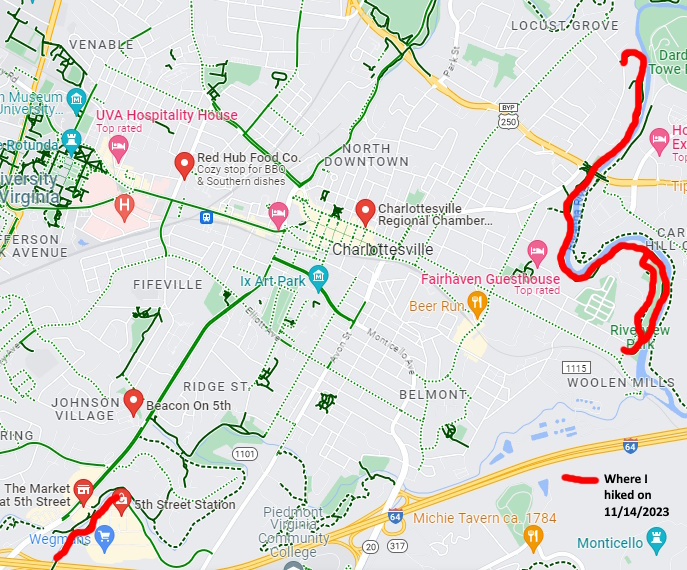
This series of hikes took place on Tuesday, November 14, 2023, consisted of a 2 mile up, 2 mile back on the Rivanna River Trail and a .25 mile up, .25 mile back on the Biscuit Run Trail for a total of 4.5 miles. It was just me on this trip.
I left Manassas, VA at around 8:00 AM. It was 41 degrees at that time. There was an accident on US29 north of Charlottesville so I didn’t get the the Rivanna River trailhead at Riverview Park until about 10:30 AM. There are portapotties at this park, which is on the east side of C’ville. I used one and then started the hike. It was 51 degrees out when I started.
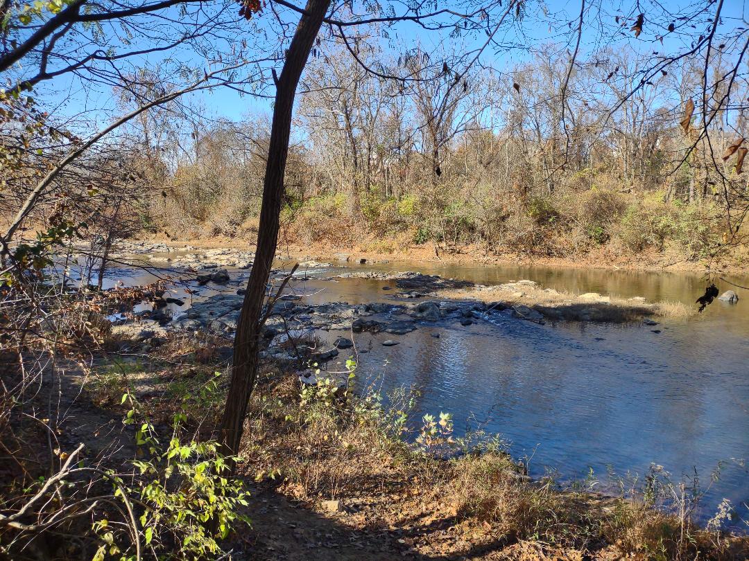
This trail was very level and paved. It followed the west/south banks of the Rivanna River, which flows partially around Charlottesville, VA. For the first quarter mile there were two parallel trails. I took the trail furthest away from the river. The two trails merged into one at around a quarter mile.
The views of the river were very scenic. The Rivanna River didn’t look very deep but you never know. There were a few people on this trail today I either passed or got passed by 5 runners, 4 bicyclists, 2 hikers and two people walking dogs. After about 1.5 miles I went under the US250 bypass bridge also called the Freedom Bridge. There was a homeless encampment under the bridge. The trail also went by a number of commercial businesses in this area.
There was a also trail and a road on the other side of the river. I could see people running and walking their dogs there as well. I even passed a US Army soldier walking this trail with a full pack on. At around mile 1.75 there were massive amounts of bamboo trees on each side of the trail. They were so prevasive that there was a bench near the trail facing the river. The bamboo literally obscured the view.
When I got to the 2 mile mark the trail turned left and went out to River RD. There was a sign just past this point that said that the trail was closed due to private property owners. I understand that property owners have a right to say no to trails across their property. I assume that the liability issue, trash issues and people bugging them to use their phone, get a ride, use their bathroom, etc are a factor.
So at this point I took a quick break at one of the benches. It was now 11:30 AM. I then started the return trip. I’ve found that, when doing these up & back hikes, the return trip was usually faster as you knew what to expect scenery wise and terrain wise. At the 3.6 mile mark I took the trail closest to the river on the way back. I made very good time on the way back.
I got back to Riverview Park at 12:10 PM. That’s 1 hour and 40 minutes to do 4 miles. Not bad. I then set my GPS to go to the 5th Street Station shopping center. I wanted to hike the Biscuit Run Trail from the 5th Street Station south to I64. When they open Biscuit Run Park next year, I plan to go to it and hike back north to I64. It took me about 12 minutes to get to this shopping center.
Unfortunately, I had to drive around the shopping center 3 times before I found the trailhead. It was very strange in that you had this new suburban shopping center and various fast food and other businesses scattered around this area. However, there were no signs for the trail. After the third try I parked my vehicle, got out of my vehicle, walked around and then found the trailhead.
Not only was there no signage but there were no blazes. But what was really strange was that the trail looked like it was well used. One had to hike down into a canyon that Biscuit Run flowed through. You couldn’t see this canyon while driving around the area. The trail descended to Biscuit Run, then ran along the east side of it . I walked this trail for about a quarter mile. I passed 2 people on the way up and one on the way back. There was an iron gate at the half way point. The gate was open though. So I made it to I64, then turned around and walked back to my vehicle. It was Now 1:15 PM. So I started back home, got some $2.99 gas as well as a Wendys single and a mint Frosty on the way and made it home by 3:20 PM.
This was a great hiking day. The weather was fantastic, I discovered two new trails and saw a lot of neat sights. And I found out that I had hiked another section of the 20 mile Rivanna Loop Trail today. I’ve now done about 20% of this trail. I can’t wait until the new Biscuit Run Park south of C’ville and I64 opens next year. It will be another excuse to come back to this really neat place.
Mike C


")


< Previous Trip Log | << Outdoors | Next Trip Log >