
This trip log may contain an afffiliate text link. If one clicks/taps on this link and then makes a purchase, I sometimes receive a small commission. Please patronize our advertisers. This roughly 3 mile hike took place on Tuesday, April 16, 2024. It was only me on this one.
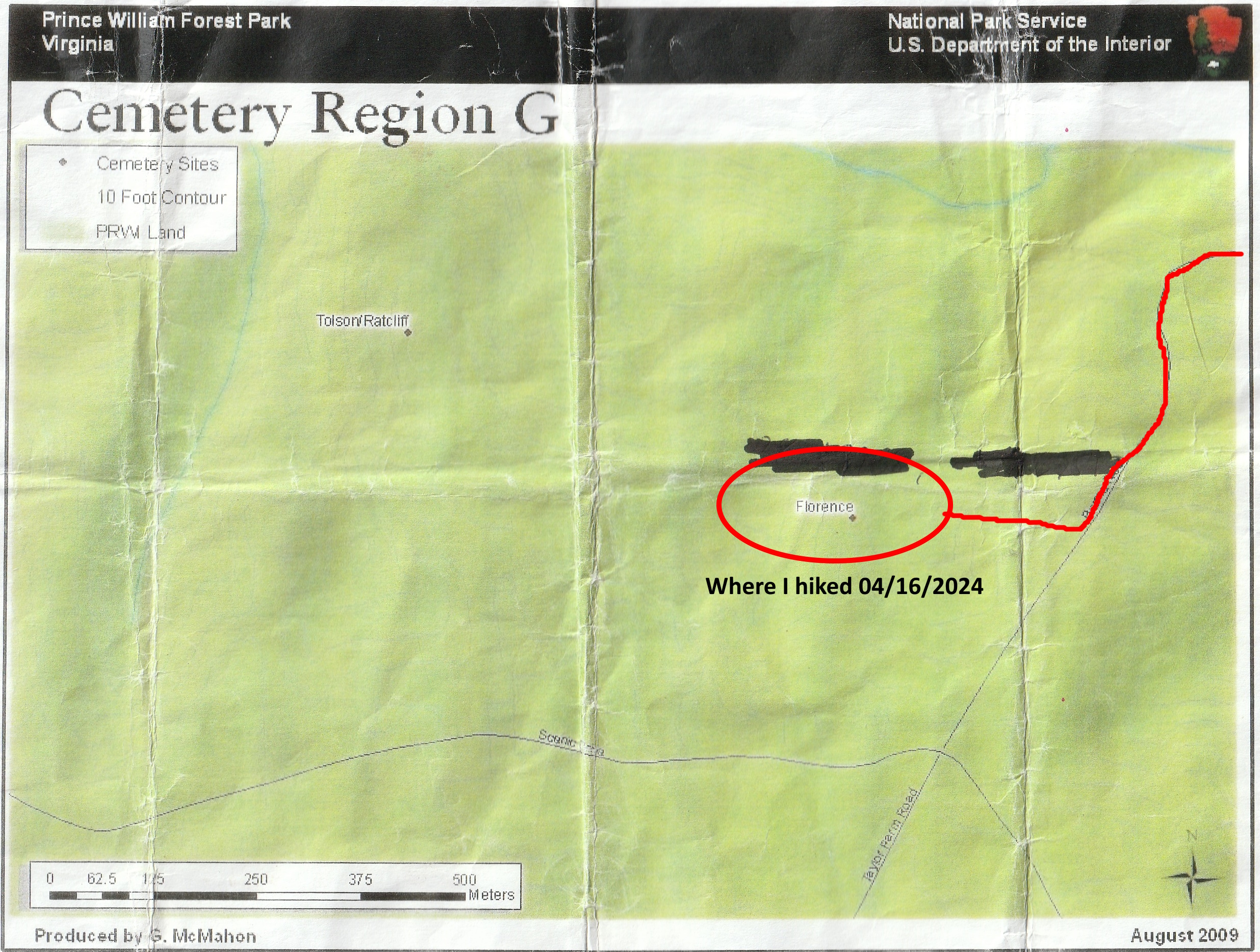
The purpose of this hike was to find the Florence Family Cemetery in Prince William Forest Park. It is one of about 41 family cemeteries in this park. I have now been to about 9 of them.
I arrived at the Montclair Shopping Center at the corner of Waterway DR and VA234 in Montclair around 8:30 AM. I then crossed VA234 and entered Prince William Forest Park via Spriggs LA. After about a quarter mile I got onto the Burma RD. Both of these roads are really gravelled fire roads within the park. I then crossed over Quantico Creek North Branch and started the 400 foot climb on Burma RD as it makes it’s way to the Scenic Drive within the park.
However, I would not go all the way to the Scenic Drive. I would stop just as Burma RD was straightening out to make it’s final climb to the Scenic Drive. I stopped at this point, got out my compass and set my Bushnell Back Track device to get me back to this point. I tried getting the GPS coordinates for the Florence Family Cemetery. However, the coordinates that I got online were wrong. One set put me along US17 in Stafford, VA and the other put me in the Potomac River.
So I set off to bushwhack my way to the Florence Family Cemetery with the information that I had. Bushwhacking is not easy. You are constantly dealing with Greenbrier that will tear your arms and legs up, blowdowns that you have to climb over, creeks that you have to either ford or go way upstream to a point where you can cross them, trees that may fall on you, ticks and snakes. So you don’t make great time bushwhacking in the woods.
The direction that I started walking was west by northwest. The setting on my Zuunto compass was 300. So I kept the compass pegged to north and hiked towards the 300 mark. After about 1,200 feet I came to a stream. I could not cross it because the streambed was too steep. I had to walk about 100 feet south and cross where the stream was narrower and more level.
Interested in AI Chat Bots on your Shopify Store? Check out QuickCEP.Soon I came upon an old roadbed. I had read that this road had originally started at the intersection of the Scenic Drive and the Burma RD. It hasn’t been used in close to 90 years. Trees had grown up on it. And blowdowns covered a good deal of it. You could still see the indentation of it. So I thought “A water source and an old road. The family must have lived near here.” After a few hundred more feet I came across a level area where there were only young trees. I thought that this must have been their homestead. However, I looked at Google maps on my phone and saw that I was getting close to the Scenic Drive.
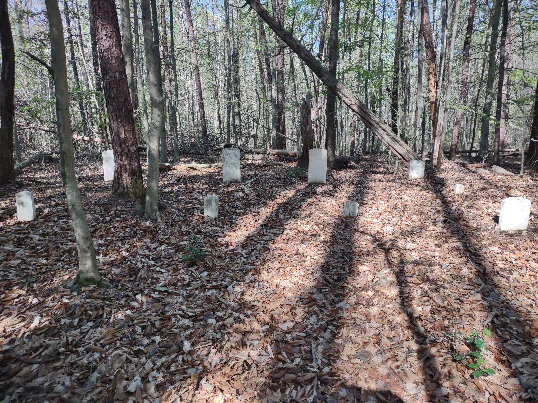
So I turned back and again and returned to the old road. I turned left and followed the old road for about 500 feet. Again, it was difficult due to massive blowdowns. Just as I was about to give up and go home, I spotted a white tombstone in the distance. That was it! I found the Florence Family Cemetery.
I took a number of images and spent about 15 minutes at the gravesite. The five headstones were well preserved. They looked to be marble. There were also footstones, which were a common practice back then The inscriptions were in good shape. There were graves for the mother, father and three offspring. Two of the children died within a year of being born. The date range of these graves were from 1836 to 1914.
After about 15 minutes I got out my Bushnell Backtrack device. It would lead me back to the point that I started on Burma RD. This product has saved my keister numerous times in the woods. It is GPS based and allows one to find their way back to their starting point. I believe that it has been discontinued at this time.
I made my way back out to Burma RD at around 10:00 AM, then made it back to my vehicle by 10:30 AM. I’m glad that after about a half dozen attempts, I finally found the Florence Family Cemetery.
Mike C
< Previous Trip Log | << Outdoors | Next Trip Log >


