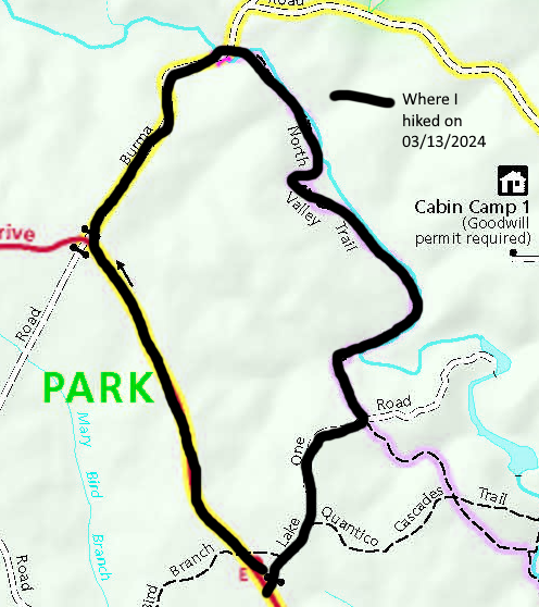
This approximately 3.5 mile loop hike within Prince William Forest Park, Triangle, VA, took place on Wednesday, March 13, 2024. It was just me on this one.
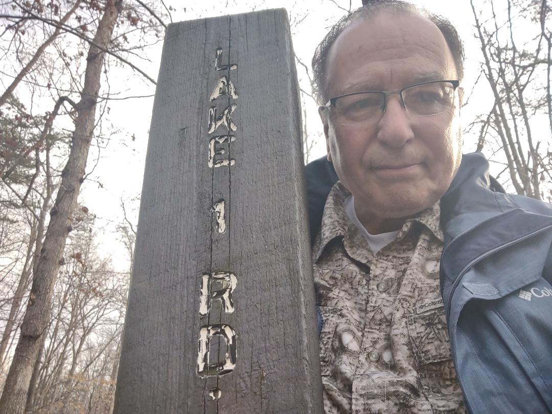
I got to parking lot E on the Scenic DR within PWFP around 10:15 AM. Traffic was terrible. I started off on this counterclockwise loop by walking the Lake 1 Fire RD. It split at around .3 miles. I passed a blowdown at .4 miles (which I reported two of to the park maintenance superviser afterwards) and got to the North Valley Trail at around .5 miles. I turned left or west, then proceeded down to Quantico Creek North Branch. I walked along this trail and next to the creek for about .5 miles. Then I started the first of two 400 foot ups.
It was tough but I felt OK. When I got to the top I crossed a small stream on a bridge, ridged for about .2 miles, stepped over another blowdown and was about to start a big down. I wanted to see if the park had gone ahead and relocated this section of trail away from the creek as it had been “flagged” about 5 years ago. The trail wasn’t relocated and I could see no evidence of flags.
Then I started a long descent and hiked another .5 miles to a bridge over Quantico Creek North Branch. The bridge looked fairly new. I then made it out to Burma RD. I turned left and started another 400 foot up along Burma RD. While ascending, I would first look for another section of trail that was flagged as a future extension of the North Valley Trail. At one time you could see the flags from Burma RD going west. They were no longer there.
Next I started looking west as there was supposed to be an old family cemetery off to the west about 400 feet below the Scenic DR on Burma RD and west of that RD. It was called the Tolson Cemetery. I didn’t see it but I did see a thin red and white marker about twenty feet into the woods. So I’ll have to go back and see if that marker leads to this cemetery. I’ve been trying to locate it for about seven years now.
When I reached the Scenic DR, I took a quick break, then turned left and started the 1.2 mile hike back to parking lot E. It was very warm then. I was mad that I had forgotten my hat. I could feel the sun beating down on my bald head. I made it back to my vehicle by about 11:15 AM. This was a nice hike. It’s amazing that I had never done this loop before. But I’m glad that I did it today.
Mike C


< Previous Trip Log | << Outdoors | Next Trip Log >