
This approximately 3 mile linear hike occured on Tuesday, January 30, 2024. Participants were Charlie Johnson, Chris Isham and me.
It was “The Rag Tag Rangers Alumni Group” on this hike. We all met at the McDonalds in Damascus, MD before 9:00 AM. We used the facilities and bought some stuff to eat/drink. We then drove a few miles to the Ridge Shopping Center anchored by a Weis Market and Chris waited for us there. Charlie and I drove two vehicles to the Loghouse RD parking area about 4 miles away and left my vehicle there, Charlie then drove me back to the Weis Market and all three of us started the hike from there. We immediately ran into our first “opportunity” right at the start of this hike. The map showed the Magruder Branch Trail starting at the rear of Damascus High School. What the map didn’t convey is that there are a series of fences all around the school. They looked new and were understandable for security reasons. But at this point in time, the only way to access the northern terminus of this trail is to either take a chance that the various gates between the fields at the back of the school are unlocked and walk to the far right (just past the tennis courts) ball field and access it there or bushwack in the woods behind the school and catch the trail that way. We did the latter. There were 25-30 baseballs laying in the woods behind the ballfields. That’s a lot of money that the school could be recycling. I’m sure that the school doesn’t want people traipsing across their fields, especially during school hours, to get to a nearby trail due to security reasons in lieu of the current shooter issues at many schools.
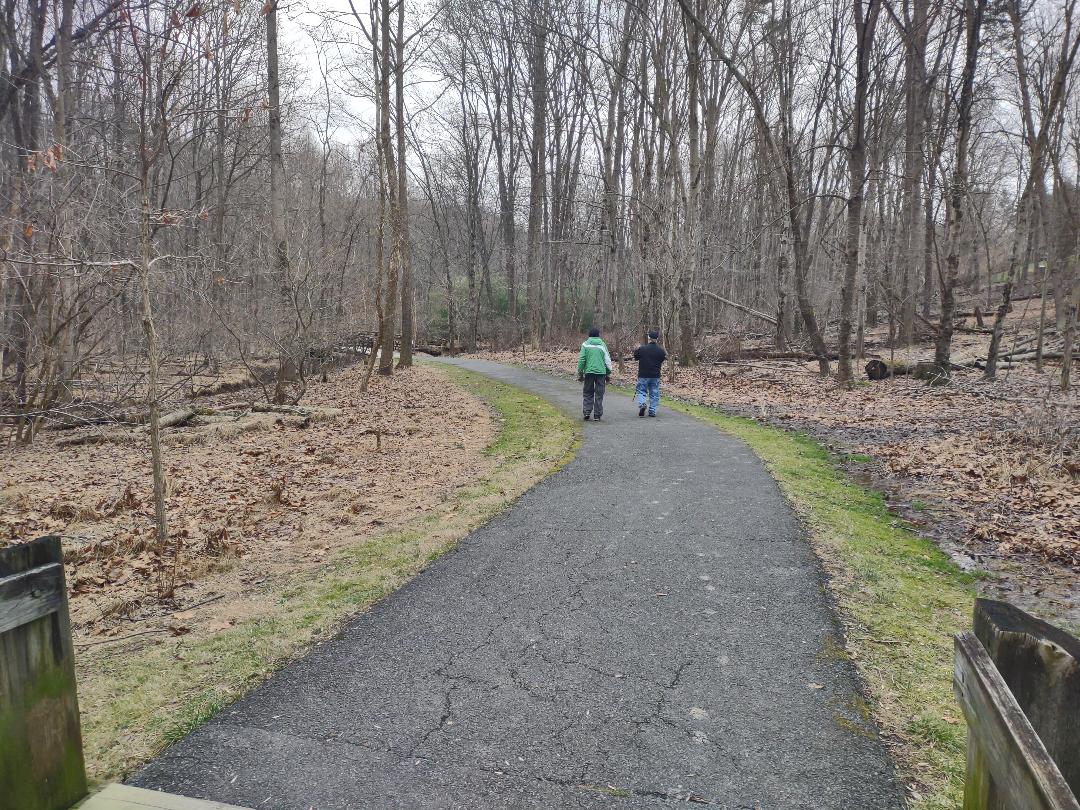
In my opinion, if Montgomery County, MD owns the land behind the school, they should extend the trail out to Bethesda Church RD. Once we finally got on the trail, it was nice. The majority of what we hiked today was paved. There were a lot of bridges and boardwalks along this trail as the area was boggy. It was a pleasant downhill to level walk. After the first half mile or so we crossed Valley Park DR. If you’re not a purist, this is the best place to park and start this hike. After crossing this road the trail got closer to Magruder Branch. We saw about 5 people on this trail. One gentleman we saw near the end of the hike while shuttling vehicles on Kings Valley DR passed us twice while on this stretch. He was doing a pretty fast paced jog. Good for him!
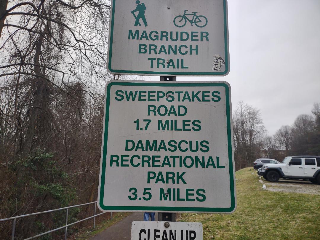
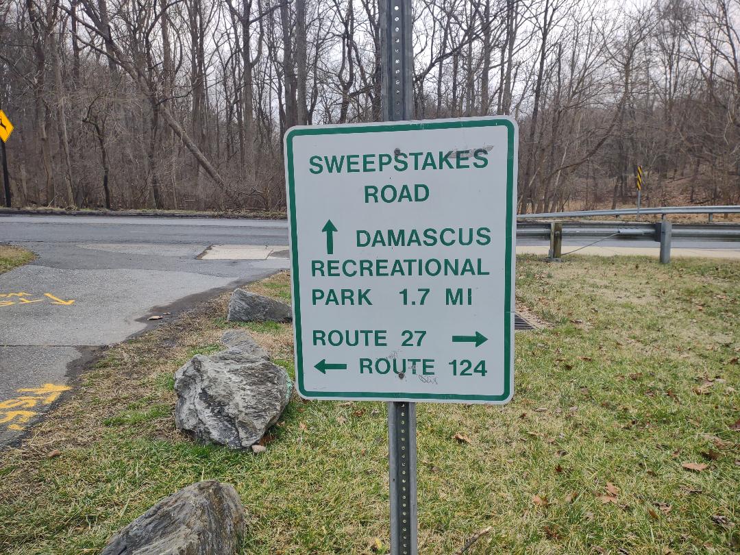
Again the trail was level to downhill with lots of bridges, boardwalks and side trails to various neighborhoods. After 1.7 miles we came to Sweepstakes RD. The trail crossed the road but one had to turn right, walk about 100 feet and then turn left to continue on the trail. After about .5 miles the paved trail turned to the right, crossed Magruder Creek and was headed towards Damascus Regional Park. There was a dirt trail to the left right after this turn. It was blazed blue just like the trail that we had been hiking on. But the trail just ahead was also blazed blue. Hmm, someone messed up. Luckilly, I had the hikingproject.com app up and it showed this dirt trail heading back to Loghouse RD and our vehicle. So we took it.
This trail was very short, probably less than a half a mile. But we had a couple medium ups and downs on it, passed a water treatment plant, got to Loghouse RD, turned right on a side trail that led to a nice trail parking area and the end of the hike. We all piled into my vehicle and drove back to Weis Market. Chris, Charlie and I all said our goodbyes and we went home. This was a nice, short hike. On February 27, 2004 we plan to do the last secrion of this trail that I have to do. It will be about 6.5 miles and will be between Watkins Mill RD and a point within Seneca Creek State Park. Then I will have hiked all 29.9 miles of the Magruder Branch/Seneca Creek Greenway Trail. I’ll be releasing a distance calculator for this combo trail soon and, when I finish the last section, I will post links to all the sections that I hiked, the distance calculator and other pertinent information about this trail. If anyone wants to join us for this February 27, 2024 hike, please let me know.
Mike C
Map of where we hiked.
(Please note that we only hiked the top half of this map.)


By Charlie Johnson

By Charlie Johnson
< Previous Trip Log | << Outdoors | Next Trip Log >