
This page may contain an affiliate ad banner and/or text link. If one clicks/taps on this link and then makes a purchase, I sometimes receive a small commission. Please patronize our advertisers.
This 4.4 mile loop hike occured on Wednesday, December 10, 2025. It was just me on this one.
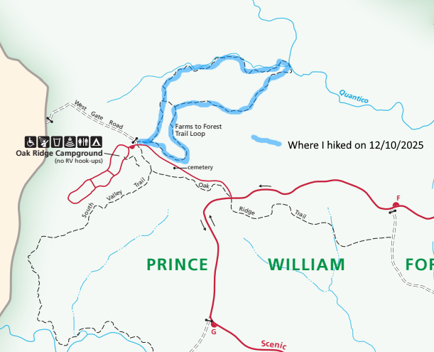
Since Wednesday was looking like the best day of the week weatherwise, I decided to take a hike that day. I chose the Farms to Forest Trail in Prince William Forest Park. The reasons are that it had been four or five years since I hiked this trail. And I had last hiked it with fellow hiker Tom O’Brien, who passed away in 2024.
When I arrived at the trailhead near the Oak Ridge Campground it was in the upper 30’s temperature wise around 10:30 AM. I wore a flannel shirt, my Omni Heat jacket, a stocking cap and gloves. Again, this combination kept me warm during this hike. This hike is basically two loops pieced together. The Farms to Forest Trail is blazed yellow and green while the extension is blazed yellow.
The main loop was somewhat level. When I got to the extension, that’s when I started encountering a number of ups and downs typical of what one encounters while hiking in most of PWFP. There was still some snow on the ground. But is was mainly covering downed trees. Speaking of downed trees this park has a bunch of them. That could be a future factor causing forest fires in this area.
So I kept doing these ups and downs and after about 2 miles I finally got to Quantico Creek North Branch. I turned left on this counter clockwise loop, walked along the creek for about a quarter mile, then turned left again and started my return to the campground. As far as maps go, I first just utilized the .pdf of the hiking trails in this park from the nps.gov website. But a bit past this point, I brought up AllTrails because I wanted to see how far away I was from my vehicle.
Surprisingly, I had cell service for just about all of this hike. I passed a beaver dam at one point. Then later on I started passing many knawed stumps and downed trees that the beavers had created. At one point, I even observed a de facto trail that the beavers had created by dragging trees down a hill towards another dam further along the creek.
Once I got back on the original loop of this trail I knew that I was close to being done. I actually felt pretty good at this point and was taking the ups at a good pace. The weather at this point was cloudy and in the low 40’s. This is the second hike in a row where I was the only person on the trail. I sort of like this isolation.
In closing, I got done around 12:30 PM and made it back home by around 1:00 PM. I have made a commitment to myself to make hiking more of a priority in 2026. I will have an announcement soon about some hikes that I will be leading next year for a hiking group. Stay tuned.
Mike C


< Previous Trip Log | << Outdoors | Next Trip Log >