
This page may contain an affiliate ad banner and/or text link. If one clicks/taps on this link and then makes a purchase, I sometimes receive a small commission. Please patronize our advertisers.
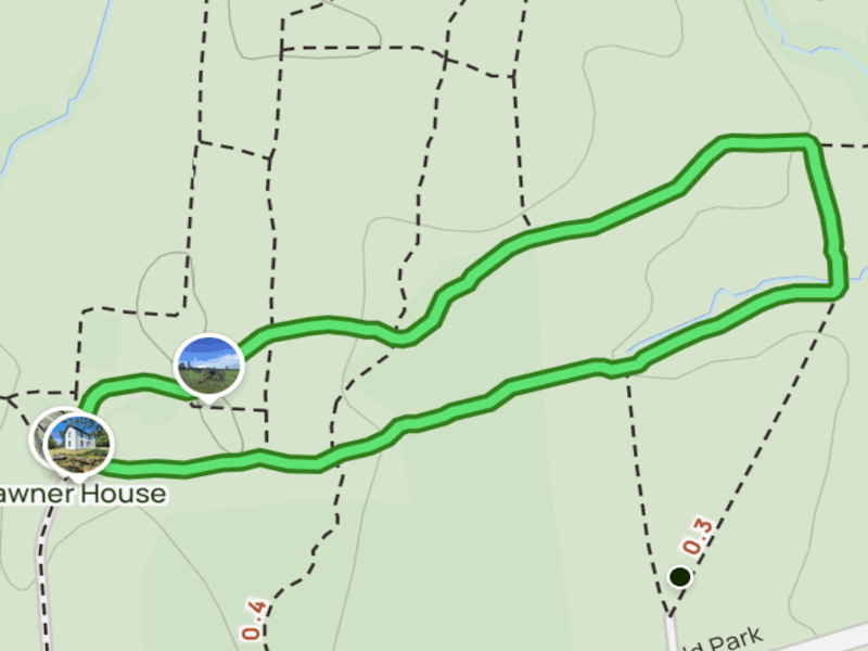
This 1.3 mile loop hike took place at Manassas National Battlefield Park on Tuesday, November 11, 2025, Veterans Day. It was just me on this one.
I haven’t had many opportunities to hike lately. And I knew that I had to get out there again. So, as a last minute decision, I decided to go and hike the Brawner Farm Loop Trail within MNBP, VA.
It was about 11:00 AM when I arrived at the parking lot on Pageland LA that leads to the trailhead for this hike. I immediately noticed that the spur trail across the street that provided the connection from MNBP to Conway Robinson State Forest was blocked. This was due to a planned data center right across the street from the battlefield that is currently in litigation. That fence made me angry. I did read that Prince William County plans to provide a connector trail to the battlefield from the
when it is eventually extended to Conway Robinson State Forest. I hope that becomes a reality. So I parked my vehicle near the prefab forest service restroom and started the hike.
It was about a quarter mile from the parking lot to the Brawner House. I crossed a nice Trex planked bridge along the way (POPUMC take note). This is where the loop started and ended. It was 41 degrees and breezy when I started this hike. According to
This house was the scene of fierce fighting during the Battle of Second Manassas in 1862. Today, this house has been totally refurbished and is a seasonally open Intrepretive Center.
So the loop trail started in front of the house. It was mostly level and was a combination of mowed grass, dirt, boardwalks and bridges. There were interpretive signs along the way. The park service has changed the landscape in this area greatly over the last 10-15 years. It used to be mostly woods. But the park service wanted to return the land to the way it looked in 1862. So the trees came down and the area was returned to farmland. That’s all well and good. However, there are now very few trees in this area. It was cool the day that I hiked this trail. But I can just imagine that it would be hot as hell to hike this loop in the summertime.
This was an oval shaped loop. It intersected a few trails, went ove a few streams and, after aboyt .7 miles, turned around and made it’s way back to the Brawner House. The signing was OK. I did come to 1 intersection where it was obvious that the person mowing the trail in this area placed the trail signs off the trail. But they didn’t put them back at a four way intersection. Thank God I was using the AllTrails app on this hike as it pointed the right way to go.
I made it back to the Brawner House around 12 noon. I passed two people on this loop and saw three other people on the other side of this loop while I was hiking it. I felt good after doing this hike. And my knee seems to be getting better. I am going to make a concerted effort to start getting out more regularly to hike. If the reader is an average hiker and would like a nice hike to do on a sunny day, this one would be perfect. As long as it is not really hot.
Mike C


< Previous Trip Log | << Outdoors | Next Trip Log >