
This page may contain an affiliate ad banner and/or text link. If one clicks/taps on this link and then makes a purchase, I sometimes receive a small commission. Please patronize our advertisers.
This 2.2 mile up, 2.2 mile back (4.4 miles total) day hike took place on Tuesday, June 10, 2025. Participants were Chris Isham and me.
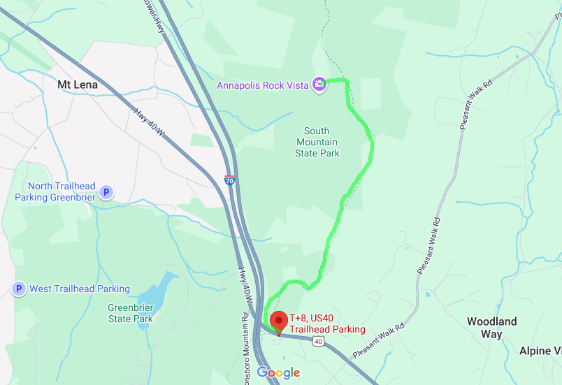
I met Chris at the US40 parking lot just before it crossed over I70. It was about 8:50 AM and the temperature was around 65 degrees. We said our hellos, put on our packs and started the hike. It distance was not bad up to Annapolis Rocks, only 2.2 miles. But it was the 600 foot elevation change over those 2.2 miles that would be the challenge.
We took a group selfie at the north end of the footbridge over I70, hiked under the US40 bridge, then started the long up to Annapolis Rocks. First, we stopped at the Pine Knob Shelter so that I could use the facilities. This is the oldest trail shelter in Maryland and one of the oldest on the entire AT. We then started back up the trail.
Since the trail corridor is narrow, there are no switchbacks going up South Mountain. You go straight up. To make matters worse, someone placed medium sized tree trunks across the trail to mitigate erosion of the soil within the trail bed. However, one has to step over these unevenly spaced obstacles the majority of the way up the mountain, making for a challenging trip.
It seemed like the ups lasted forever. But after about 1.8 miles the trail leveled out. We had a short level stretch, then came upon the left hand entrance to Annapolis Rocks. I’ve backpacked this stretch twice and day hiked up from US40 twice before. So I knew what to expect. This area is also a backpacker’s campground. I’ve camped here twice. There were only a handful of people when we got there. So we proceeded to the overlook, sat for awhile and just enjoyed the view. It was around 10:30 AM.
We probably spent about 20 minutes at the overlook. It was fantastic. We then took some images, then started the southbound 2.2 mile trek back down the mountain to our vehicles. We started seeing many people coming up the mountain as we were going down. We were also passed by numerous people who were day hiking south from points north. I got a phone call from my son Andrew along this stretch. He invited me to breakfast on Fathers Day. I accepted.
Coming down the mountain was not much better than going up. One had to step over those tree trunks and it was jarring to one’s feet. It was getting warmer on the way down. The tree canopy covered us most of the way. But when exposed to the sun, it was hot. We made it back to our vehicles, said our goodbyes and started home. It was around 85 degrees at that time. I got back home to Manassas, VA around 2:15.
It was great hiking with Chris. She seemed to effortlessly glide up and down the mountain while I had to work hard to keep up. Yes, the trek from US40 to Annapolis Rocks was a tough one. But the wonderful view that one gets at the top definitely makes the trip worth while.
Mike C


< Previous Trip Log | << Outdoors | Next Trip Log >