This day hike occured on Tuesday, January 28, 2025. It was an easy 3.3 mile series of up and backs. This hike was sponsored by the
and was led by John Hoffman.
I arrived at the wrong parking lot along the Luray Hawksbill Greenway at around 8:50 AM. Charlie Johnson arrived at the correct parking lot shortly afterwards. After a phone call, I walked about a quarter mile to where Charlie was parked. We talked for awhile and waited for the rest of the hikers to show up.
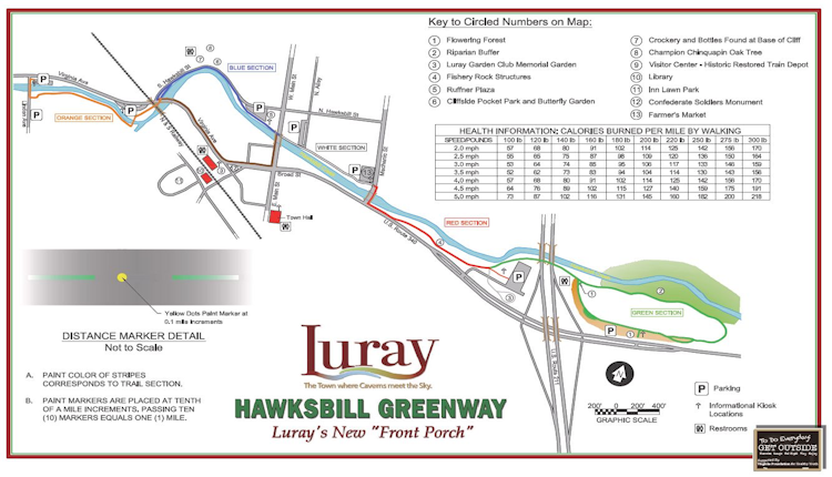
And show up they did! By the time leader John Hoffman called us all together for a group picture, there where about 40 hikers there. It was a beautiful day! Temps were around 40 when we started and right at 50 when we ended this hike. Since we started at the midpoint of the trail we first proceeded south on the trail for about .75 miles. We wove around the town and went under two bridges, along Hawksbill Creek and then got to the southern terminus of this trail at Linden AVE. It was marked by an American Flag on a pole. We then turned around and started northbound.
Since I was curious if the reason that since this trail was named the Luray Hawksbill Trail, that Hawksbill Creek had it’s source just below Hawksbill Peak, the highest mountain in Shenandoah National Park, VA. So I looked on Google Maps to verify this. Sure enough, Hawksbill Creek starts right below the summit, then travels in a northwesternly direction through Luray, VA and then terminates at the Shenandoah River a few miles north of Luray.
There were various murals and carved figures along the way. We also hiked past various various houses and businesses. We walked past where we started the hike and proceeded north parallel to US 340 Business. We walked under the US 211 bridge, then walked around the perimeter of a huge former farm field. There were numerous parking lots, rest rooms and portapotties along this trail. The second segment was about 1.8 miles. We got it done, got back to my vehicle, then drove to Charlie’s vehicle.
It was now around 11:30 AM. We drove to a restaurant in town called Gathering Grounds. It looked like about half of the hikers went to the restaurant after the hike. The food was very good and moderately priced. I then said goodbye to everyone and hit the road around 12:45 PM. I got home around 2:15 PM. This was the first hike that I have been able to participate in since the First Day hike that I did on January 1, 2025. You can read about this hike
This was due to the cold and snow between New Years and now. So it was really nice to get out today. Nice hike. Great fellow hikers.
Mike C


By Charlie Johnson


< Previous Trip Log | << Outdoors | Next Trip Log >